Speed and efficiency
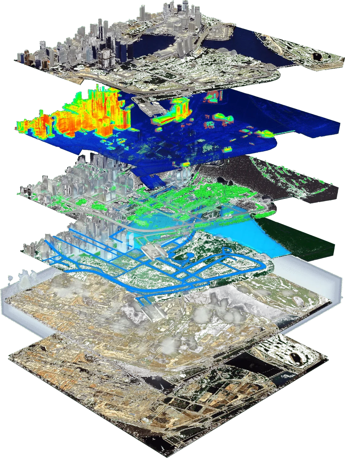
An automated AI pipeline segments and understands satellite and street images, video and point clouds. It then generates geo-specific and geo-typical parametric 3D twins that are dimensionally accurate and hyper-photorealistic.
For earth mapping
The patented VIZZIO platform that turns satellite imagery and geospatial data into detailed, photorealistic 3D digital twins of cities.
We are building the world's most comprehensive whole-Earth digital twin. Powered by AI, one city at a time.
Machine learning and a geographic pipeline turn raw satellite imagery into accurate, geometrically precise 3D environments. GIS and zoning data make each twin more useful still. Real cities become instantly available for gaming, simulation, training and architecture.
Our AI-driven process models any location on Earth and outperforms aerial photogrammetry on speed, cost and flexibility. It serves city planning, disaster management, infrastructure and environmental monitoring.
Why Earth.ai
An automated AI pipeline segments and understands satellite and street images, video and point clouds. It then generates geo-specific and geo-typical parametric 3D twins that are dimensionally accurate and hyper-photorealistic.
Any city on Earth can be modelled without drone photogrammetry. That removes restricted flight zones, weather windows and slow data collection, and it opens up regions where drones are impractical or prohibited.
Patented AI builds each twin from satellite imagery and data from leading geospatial providers. Models are positionally accurate and kept up to date, with no drones, aerial photogrammetry or government permits.
UAV photogrammetry is costly, slow and blocked by no-fly zones, so maps go stale. Very-high-resolution satellites now capture less than 0.15 metres per pixel, which makes detailed urban mapping from space practical and repeatable.
Facade texturing combines AI, heuristics, neural graphics and procedural methods. A Vision Transformer trained on more than 1,500 cities classifies every pixel into classes such as building, shadow and eight roof shapes. GIS, street names, points of interest and zoning can be layered in.
The process
Stereo images from low-orbit, sun-synchronous satellites.
AI corrects atmospheric distortion, removes shadows, sharpens resolution and reduces noise.
Building geometry, road networks and other critical detail are extracted from the imagery.
Multi-temporal imagery is combined and super-resolved for exceptional accuracy.
An optimised 3D digital twin, ready for geospatial analysis, urban planning and real-time applications. No drones or LiDAR.
The platform
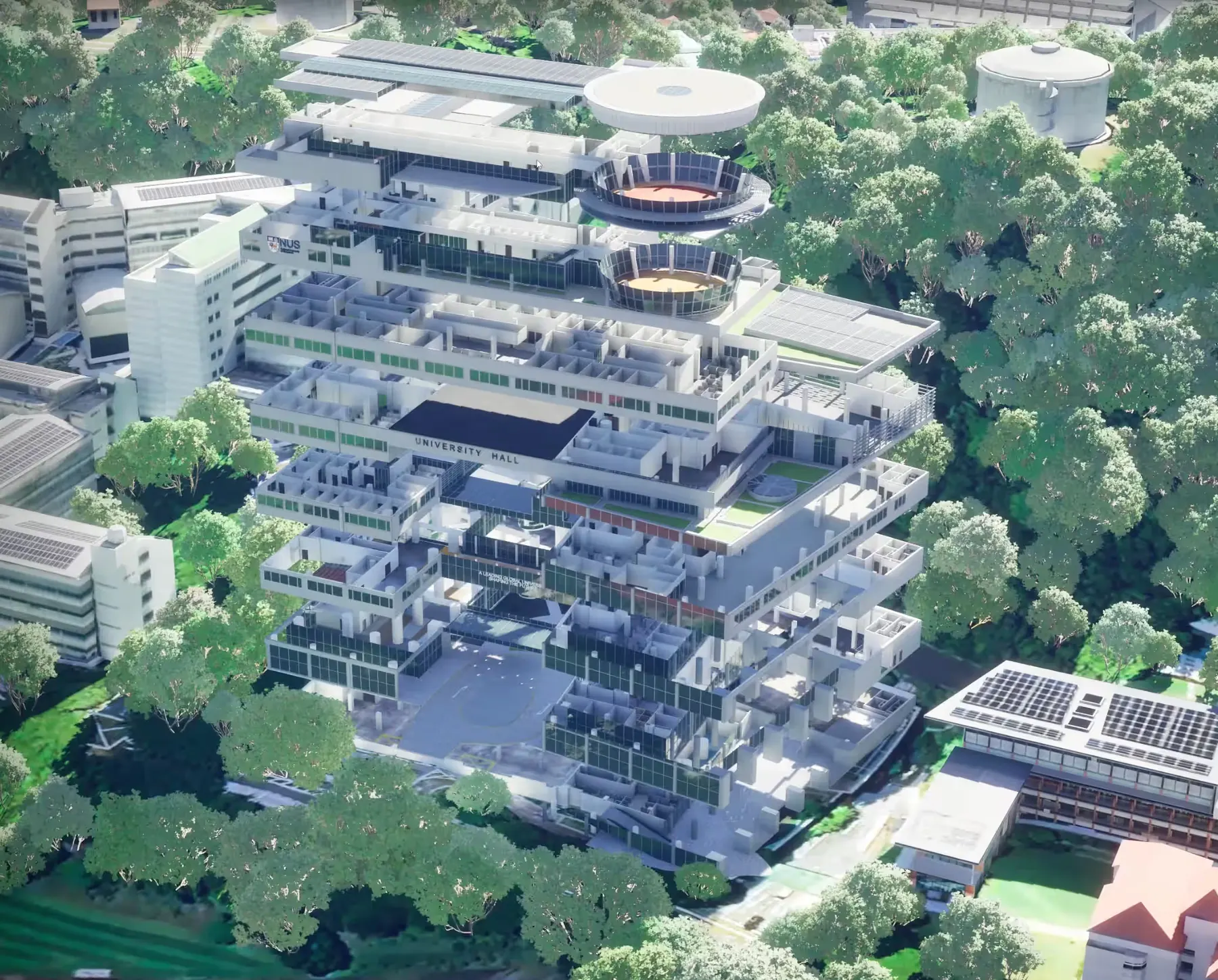
Powered by advanced AI, EARTH.AI delivers real-time, high-precision visualisation for planning, decision-making and management, from smart cities to manufacturing. Rapid, scalable 3D modelling changes how we understand the world around us.



























































Learn more
Proprietary AI turns raw satellite imagery and geospatial data into accurate, photorealistic 3D models. Machine learning classifies building elements, road networks and other infrastructure, so no drones or manual surveying are needed.
Smart cities, real estate, construction, manufacturing, energy, logistics and environmental monitoring. Uses run from infrastructure planning to simulation and security.
Models are geometrically and positionally accurate, with sub-30 cm precision. High-resolution data updates continually, so the models stay current and reliable.
Accuracy, speed and cost-efficiency. Real-time insight helps teams optimise workflows, manage infrastructure, improve safety and security, and support sustainability goals. The technology scales to any location worldwide.
Yes. Using satellite imagery and data from top geospatial providers, we model cities, regions and industrial facilities anywhere in the world.
Traditional methods rely on aerial photogrammetry or manual data collection, which is slow and costly. Our AI platform automates the process and delivers faster, cheaper, more scalable models with no drones or on-site collection.
In near real time, depending on the availability of satellite data. The AI-driven workflow keeps each twin current.
Our team tailors the solution to your needs. Whether you work in urban planning, real estate, manufacturing or another field, we help you put 3D digital twins to work on operations, safety and data-driven decisions.
Being able to 3D-map anywhere on Earth with high accuracy is a massive game changer.
Request a demo